Current filter:
Hawke’s Bay Regional Council has today released a summary of key environmental information from its five-year State of the Environment technical reports.
The 5-year SOE report is a ready-reference overview of the most noteworthy environmental issues for Hawke’s Bay communities and decision-makers, including treaty partners and stakeholders.
“This is an extraordinary report from our science team that represents Hawke’s Bay’s key environmental issues in the context of what our Regional Council is doing to address these issues,” says Regional Council chair Rex Graham.
“It’s a scorecard that feeds into many of the outcomes we’re striving for around air quality, swimmability and water security to name a few,” adds Mr Graham.
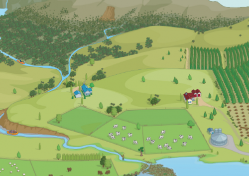
The report covers fields at the heart of the Regional Council’s in-house scientific expertise: air quality and climate, land science, surface water flows, surface water quality and ecology, groundwater resources and quality, and marine and coast.
“This five-yearly science report for Hawke’s Bay is absolutely relevant to the national freshwater reforms taking place and our planning processes to give effect to these regulations as they change,” says Regional Council chief executive James Palmer.
“It’s also giving us a clear steer that the focus we’re putting into waterways such as Whangawehi, Karamū Stream, Ahuriri Estuary, Tukituki and Porangahau is well placed. It reinforces the enormity of the environmental challenges we're facing in our region, and the large amount of work we need to do as a community,” says Mr Palmer.
To assist with readability, the report has been structured according to Hawke’s Bay’s geography into Northern, Heretaunga and Southern sections.
Twenty-one staff collect environmental information from 2 sandy beaches and dunes, 3 rocky reefs, 3 air quality sites, 5 lakes, 6 estuaries, 10 wind erosion sites, 16 nearshore coastal water quality sites, 35 river flow sites, 37 swimming sites, 50 wetlands, 50 stream ecosystem health sites, 85 river water quality sites, 89 soil monitoring sites, over 100 groundwater wells and 150 riparian areas.
The report includes an introduction and sectional summaries, written in plain English. It can be downloaded at hbrc.govt.nz, search: #documentsandforms.
26 August 2020
+64 6 835 9200
159 Dalton Street. Napier 4110
Private Bag 6006, Napier 4142
Disclaimers, Copyright & Privacy
![]()
Disclaimers and Copyright
While every endeavour has been taken by the Hawke's Bay Regional Council to ensure that the information on this website is
accurate and up to date, Hawke's Bay Regional Council shall not be liable for any loss suffered through the use, directly or indirectly, of information on this website. Information contained has been assembled in good faith.
Some of the information available in this site is from the New Zealand Public domain and supplied by relevant
government agencies. Hawke's Bay Regional Council cannot accept any liability for its accuracy or content.
Portions of the information and material on this site, including data, pages, documents, online
graphics and images are protected by copyright, unless specifically notified to the contrary. Externally sourced
information or material is copyright to the respective provider.
© Hawke's Bay Regional Council - www.hbrc.govt.nz / +64 6 835 9200 / info@hbrc.govt.nz