Current filter:
Published: 26 November 2025
Hawke’s Bay Regional Council has today endorsed the next stages of the region’s land categorisation framework, marking a significant milestone in the ongoing journey to strengthen flood resilience across the region.
On 1 May 2023, the Government released its initial risk categories and associated definitions to guide local authorities’ decision-making in respect of the risk categorisation of affected properties following Cyclone Gabrielle. Council developed a process and technical framework to assess flood risk across the region and assigned categories 1, 2 or 3 to reflect the appropriate risk threshold.
At a Council meeting on 26 November Council discussed how Category 1 and Category 3 designations will be progressively retired as updated flood hazard modelling becomes available.
Council Chair Sophie Siers says these changes reflect the progress the region has made since Cyclone Gabrielle, while keeping momentum behind long-term recovery and resilience work.
“This is the next stage in restoring Hawke’s Bay. It’s a clear signal that our region is moving forward with better information, stronger mitigations, and a shared commitment to reducing flood risk for our communities,” Ms Siers says.
Land categorisation has been a very necessary and important part of regional recovery. It enabled the flood hazards post-Cyclone Gabrielle to be assessed and identified, and was important in supporting the benefit areas for the Category 2C flood mitigation projects and the Category 3 voluntary buy out process.
Category 1, which applies to properties that were assessed as not facing intolerable risk to life, will be retired in December 2025.
Council has also confirmed that Category 3 maps, which currently reflect the best available post-Gabrielle modelling, will be phased out once updated flood hazard modelling is available and can be published on the Council’s hazard portal. HBRC will continue to work with Hastings District Council to inform any changes to the future planning provisions in its district plan.
Category 3 maps will be retired in stages, with the Esk and Te Ngarue the first to completed in early 2026. The now concluded voluntary buy out process for Category 3 properties is unaffected.
Ms Siers says the endorsement gives communities greater certainty about the path ahead.
“We’ve always said that land categorisation was a tool for recovery, not a permanent feature. As new modelling and new infrastructure come online, we can move toward a more stable and resilient future for Hawke’s Bay.”
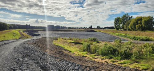
Work continues on the five major Category 2C flood mitigation projects, which will enable those communities to have their categorisations removed. Construction is now underway at Whirinaki, and is about to start at several other sites.
The Regional Council will provide updated information, FAQs and community guidance to support residents as these changes progress.
+64 6 835 9200
159 Dalton Street. Napier 4110
Private Bag 6006, Napier 4142
Disclaimers, Copyright & Privacy
![]()
Disclaimers and Copyright
While every endeavour has been taken by the Hawke's Bay Regional Council to ensure that the information on this website is
accurate and up to date, Hawke's Bay Regional Council shall not be liable for any loss suffered through the use, directly or indirectly, of information on this website. Information contained has been assembled in good faith.
Some of the information available in this site is from the New Zealand Public domain and supplied by relevant
government agencies. Hawke's Bay Regional Council cannot accept any liability for its accuracy or content.
Portions of the information and material on this site, including data, pages, documents, online
graphics and images are protected by copyright, unless specifically notified to the contrary. Externally sourced
information or material is copyright to the respective provider.
© Hawke's Bay Regional Council - www.hbrc.govt.nz / +64 6 835 9200 / info@hbrc.govt.nz