Current filter:
Published: 18 April 2019
Work at the Tukituki River estuary near Haumoana will improve the biodiversity of this area, making it more suitable for whitebait spawning.
The area where Tukituki River meets the ocean has been identified as a priority ecosystem site through the Hawke’s Bay Biodiversity Action Plan. The same space sits below a popular cycling and walking trail, with another priority ecosystem nearby at the river mouth gravel bank, which is home to many sea birds.
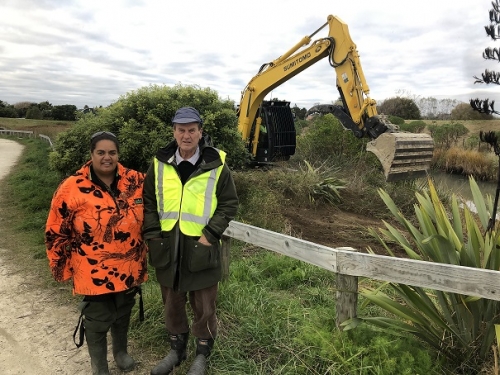
Hawke’s Bay Regional Council's Works Group has removed invasive silver poplars and weeds, leaving behind native plants and flood protection willows on both sides of the river, between Black Bridge (Mill Road) and the Tukituki River mouth estuary. Willows remain on both sides of the river, for flood protection, and these will be reinforced with new willow pole plantings this winter, and native trees next year.
Inanga (a whitebait fish species) already favour the area. These changes will create more space and better conditions for spawning. The Regional Council will reshape one bank to create a shoulder above the high tide level for spawning. Ngaio trees will be trimmed to give more light at ground level and to promote dense grass growth, which makes the best spawning habitat for these fish.
Experienced ecological advisor Hans Rook, and hapū members are monitoring the spawning alongside Regional Council staff. Hawke’s Bay has a good track record for managing whitebait habitat. Spawning habitats have been identified, protected and enhanced since the 1980s.
“Manicuring the vegetation here will give us the best production of whitebait eggs at this magnificent taonga site. Nobody else around the country can match what has been achieved with this whitebait mahi here in Hawke’s Bay,” says Hans Rook.
The Tukituki river mouth and estuary are part of Waitangi Regional Park, managed by Hawke's Bay Regional Council.
Flood control is an important feature of Waitangi Regional Park because four rivers flow through the two estuaries – Tutaekuri, Ngaruroro and Clive Rivers at Waitangi estuary and the Tukituki River at the Tukituki Estuary at Haumoana.
The Regional Council are investigating design solutions to address bank erosion near the foot/ cycle bridge at the Haumoana wetland.
+64 6 835 9200
159 Dalton Street. Napier 4110
Private Bag 6006, Napier 4142
Disclaimers, Copyright & Privacy
![]()
Disclaimers and Copyright
While every endeavour has been taken by the Hawke's Bay Regional Council to ensure that the information on this website is
accurate and up to date, Hawke's Bay Regional Council shall not be liable for any loss suffered through the use, directly or indirectly, of information on this website. Information contained has been assembled in good faith.
Some of the information available in this site is from the New Zealand Public domain and supplied by relevant
government agencies. Hawke's Bay Regional Council cannot accept any liability for its accuracy or content.
Portions of the information and material on this site, including data, pages, documents, online
graphics and images are protected by copyright, unless specifically notified to the contrary. Externally sourced
information or material is copyright to the respective provider.
© Hawke's Bay Regional Council - www.hbrc.govt.nz / +64 6 835 9200 / info@hbrc.govt.nz